Overview
About eCognition Suite
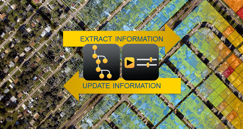
Trimble® eCognition® Suite is an advanced analysis software available for geospatial applications. It is designed to improve, accelerate and automate the interpretation of a variety of geospatial data and enables users to design feature extraction or change detection solutions to transform geospatial data into geo-information.
eCognition imports a variety of geospatial data, fusing them together into a rich stack of geo-data for the analysis. The analysis logic is structured into series of steps to create a computer-based representation of an expert’s geospatial interpretation process a so called Rule Set. eCognition then combines the analysis logic with scalable computing power to identify changes over time or features on the earth’s surface across very large sets of data.
eCognition Suite version 10.0 is a major release and includes a range of new features and bug fixes. We recommend upgrading to this new version to benefit from the new features and improvements. For an overview of the highlights please refer to the chapter eCognition Suite 10.0 Highlights. A complete list of new features and bug fixes can be found in chapter New Features - Bug Fixes and Limitations
Key Features
Building Analysis Solutions
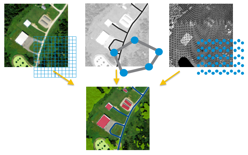
The eCognition technology examines image pixels not in isolation, but in context. It builds up a picture iteratively, recognizing groups of pixels as objects. Just like the human mind, it uses color, shape, texture, shape and size of objects, as well as their context and relationships, to draw the same conclusions that an experienced analyst would draw.
To build an analysis solution, it is possible to flexibly combine the image interpretation steps like object creation (segmentation), object classification (knowledge based, fuzzy logic, machine learning), object detection (template matching) and object modification (fusing, smoothing, orthogonalization, simplification) into a Rule Set or even a new application (Rule Set with UI) to solve the analysis problem.
The result is a unique approach to translate mind models (why a human interpreter can see the objects, changes, or features in the geospatial data) into computer understandable code (Rule Set) or an individual/customized application.
Leveraging Data Synergies
eCognition can fuse a variety of geospatial data, such as spectral image data, 3D structure data from point clouds and spatial/thematic data from GIS vectors.
The proximity of eCognition to GIS, its ability to link and fuse the available data in an analysis - combined with the straightforward export of results to GIS layers - help eCognition users to achieve outstanding results.
Efficient Workflows
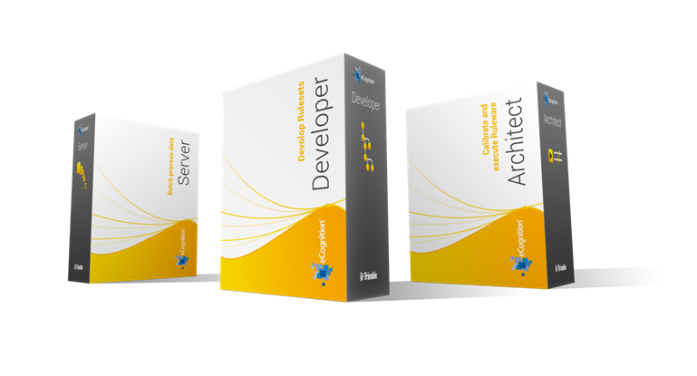
The eCognition Suite offers three different components which can be used stand-alone or in combination to solve even the most challenging fully automated and semi-automated production tasks:
- eCognition Developer is the development environment for object-based image analysis. It is used in geospatial industry to develop Rule Sets or applications for eCognition Architect for the automatic analysis of geospatial data.
- eCognition Architect enables non-technical professionals such as vegetation mapping experts, urban planners or foresters to leverage eCognition technology. Users can easily configure, calibrate and execute analysis applications (Rule Set in combination with a UI) created in eCognition Developer.
- eCognition Server software provides a powerful processing environment for batch and parallel execution of analysis jobs, based on Rule Sets or applications.

eCognition Suite 10.0 Highlights
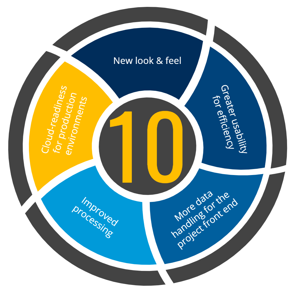
Modernized Look and Feel
A new look and feel based on a dark mode template makes input data jump off the screen and highlights active functions in the GUI.
With the integration of dark mode, data jumps off the screen, context menus are easier to consume and the use of eCognition is more energy efficient.
Our icons have been reworked to fully support 4K screens and make tools easier to recognize.
Increased Usability and Accessibility
A new start screen provides direct access to recent projects, resources and eCognition software news.
Workspaces are now standard - Simple data hosting with default Workspace creation allows direct access to project management, batch processing and bulk import functionality.
Menus and toolbars have been optimized to make workflows efficient and decrease mouse paths and clicks. Navigation windows have been standardized and searchability simplified across all tools.
Expanded Data Handling Tools
We have added valuable pre-processing tools to enable project front-end tasks directly within Developer.
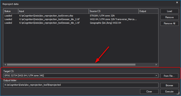
Coordinate system tools are available directly within Developer to support raster, vector and point cloud files. These tools for data projection and re-projection were added to improve data fusion, optimize project creation and increase automation.
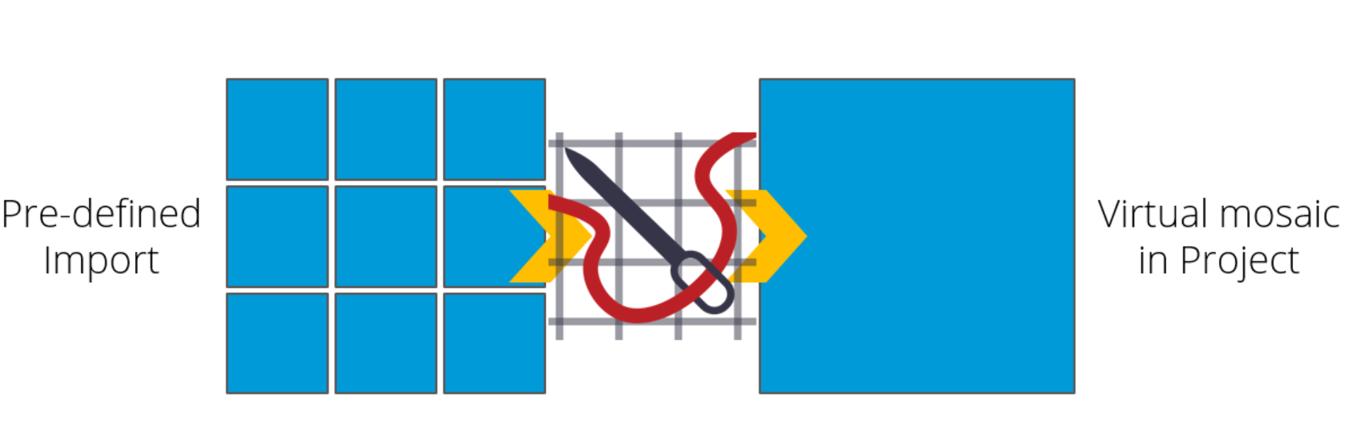
Image tile stitching upon import is available to build virtual mosaics for fast project development and production. Mosaics can be generated and new tiling schemes applied for more flexible project conception.
Principal Component Analysis (PCA) and color space transformation (HSV/HSI) algorithms have been added for more flexibility in rule set development and better support multispectral and hyper spectral data.
Extended Processing Support
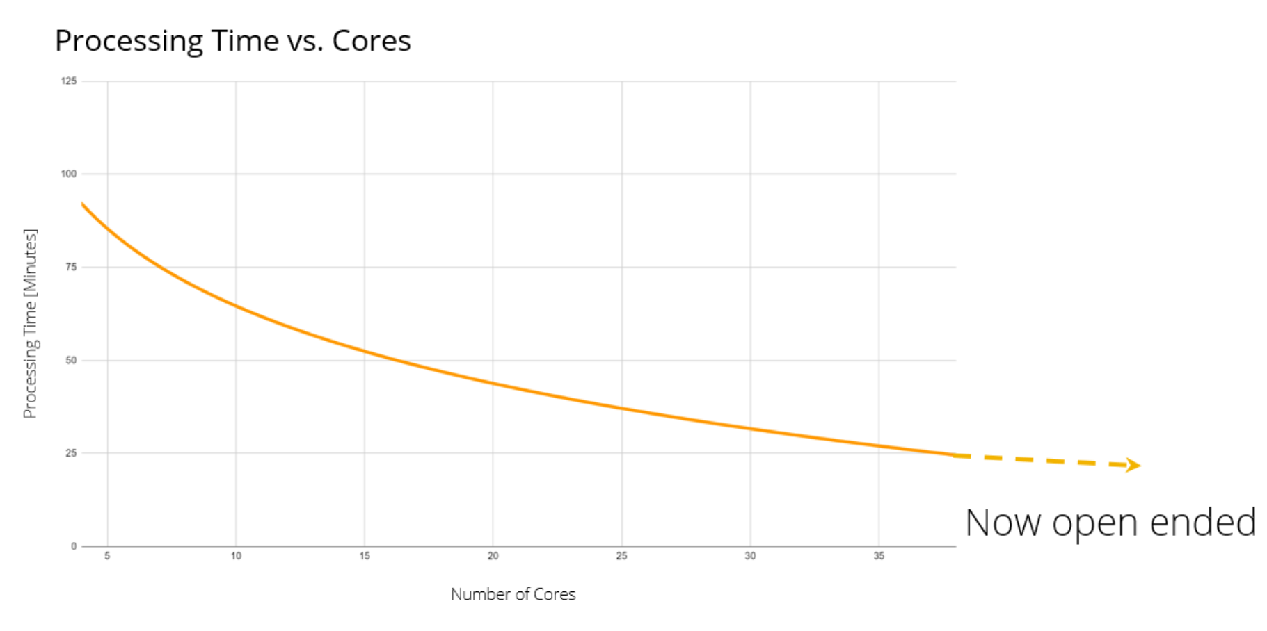
Multicore processing has been opened up - now users can define the number of cores for multicore operations (i.e. Multiresolution segmentation) and have unconstrained use of multicore operations.
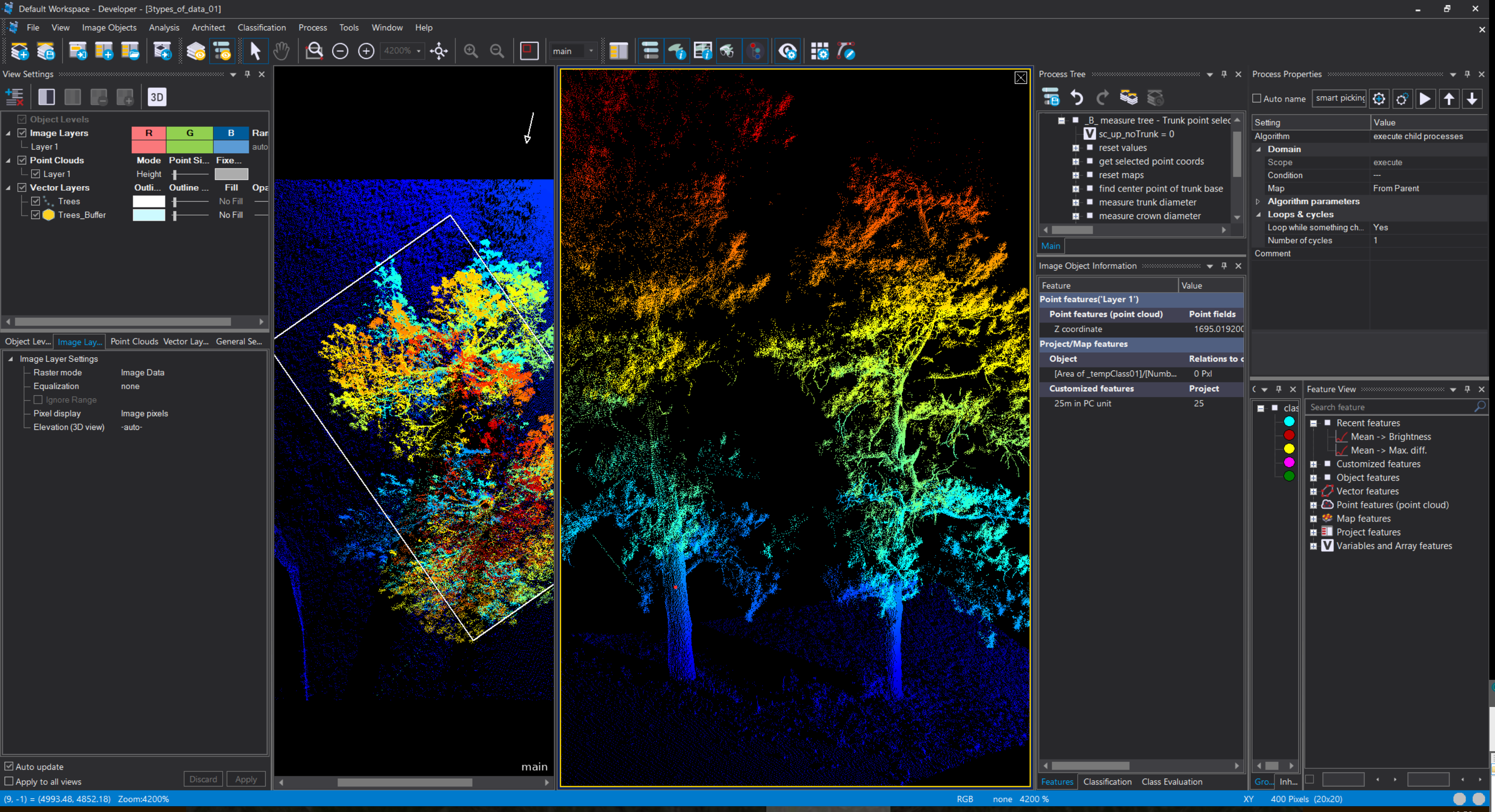
The use of point clouds has been improved through the introduction of caching.
Additional deliverable formats are supported to include PostGIS and GeoPackage to improve open source integration.
New Cloud-Readiness Capabilities
Cloud processing has been made easier to manage with the support of Docker containers. A new Docker container based Server GRID setup can be easily managed within various cloud systems.